


From 2023 to 2025, ETG and FinDev Canada implemented a Technical Assistance project to develop new deforestation monitoring technologies across ETG’s sourcing areas and contributing to our NDPE, EUDR, and SLL commitments. The project introduced landscape risk assessments and farm-level ground-truthing across cocoa, cashew, cotton, coffee, and soya supply chains. It also piloted AI-enabled voice messaging with 25,000 farmers to engage rural communities in identifying root causes and advancing deforestation mitigation strategies.
Satellite monitoring in non-EUDR supply chains
Over the past decades, various satellite-based techniques have been used to monitor deforestation in commodity supply chains, particularly in the palm oil and cocoa sectors. More recently, preparations for the EU Deforestation Directive (EUDR) have accelerated similar initiatives in the soya, coffee, timber, and leather industries.
The current EUDR approach—requiring the mapping and full traceability of every individual farmer within a supply chain—has proven to be complex and expensive for non-EUDR markets. Domestic African markets, such as edible oil, cannot absorb these additional costs without compromising affordability and food security. The same applies to cotton and cashew supply chains, which fall outside the scope of the EUDR and therefore lack access to consumer markets willing to pay a premium for such traceability technologies.
In collaboration with Findev Canada, ETG has developed and rolled out a deforestation monitoring scheme for non-EUDR supply chains of edible oil, cotton, and cashew in Africa. By adopting a risk-based approach from 1. landscape to 2. community and eventually 3. farm level- the system is substantially more cost-efficient.
First, satellite remote sensing is used to assess deforestation risk at the landscape level, following the mapping of key buying depots. Landscapes are classified as high risk only if detected deforestation exceeds a certain threshold, which triggers more detailed satellite analysis at the community level. If risks are also identified at this stage, targeted ground-truthing is conducted through farm-level GPS data collection. This tiered approach reduces the need for physical, upcountry GPS data collection that would be required under the EUDR scheme.
For the ground-truthing, a new survey assessment was developed by ETG’s partner, Empowering Farmers Foundation (EFF), incorporating farm-level observations such as tree stumps, farm establishment dates, and proximity to neighboring forests.
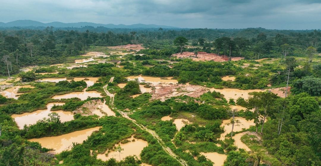
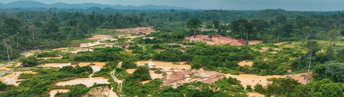
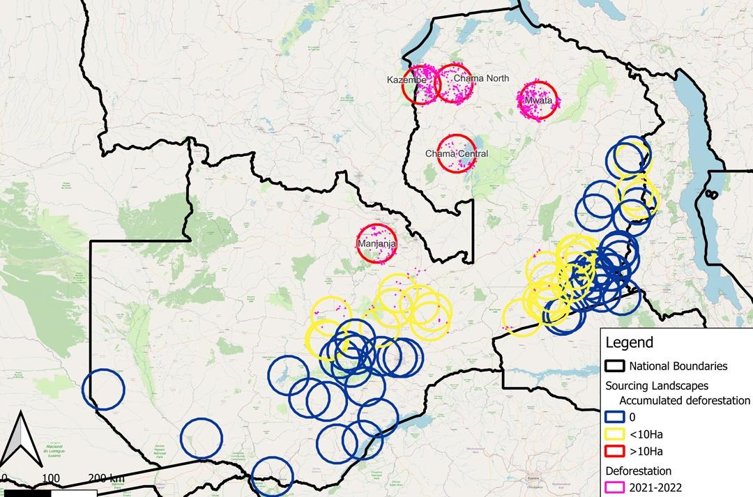
To further optimize our risk assessments and ground-truthing, ETG and FinDev Canada partnered with the Ghanaian service provider Farmerline to develop an AI-based farmer surveying scheme. A pilot was conducted across three sourcing landscapes in Ghana where elevated levels of deforestation have been observed due to illegal gold mining.
In total, 25,000 farmers were onboarded to a voice message tool asking about local observations, risks, and drivers related to deforestation and illegal mining activities. Using AI, the survey was delivered in local languages, and farmers’ responses dynamically guided follow-up questions, allowing for more efficient use of time and more targeted data collection.
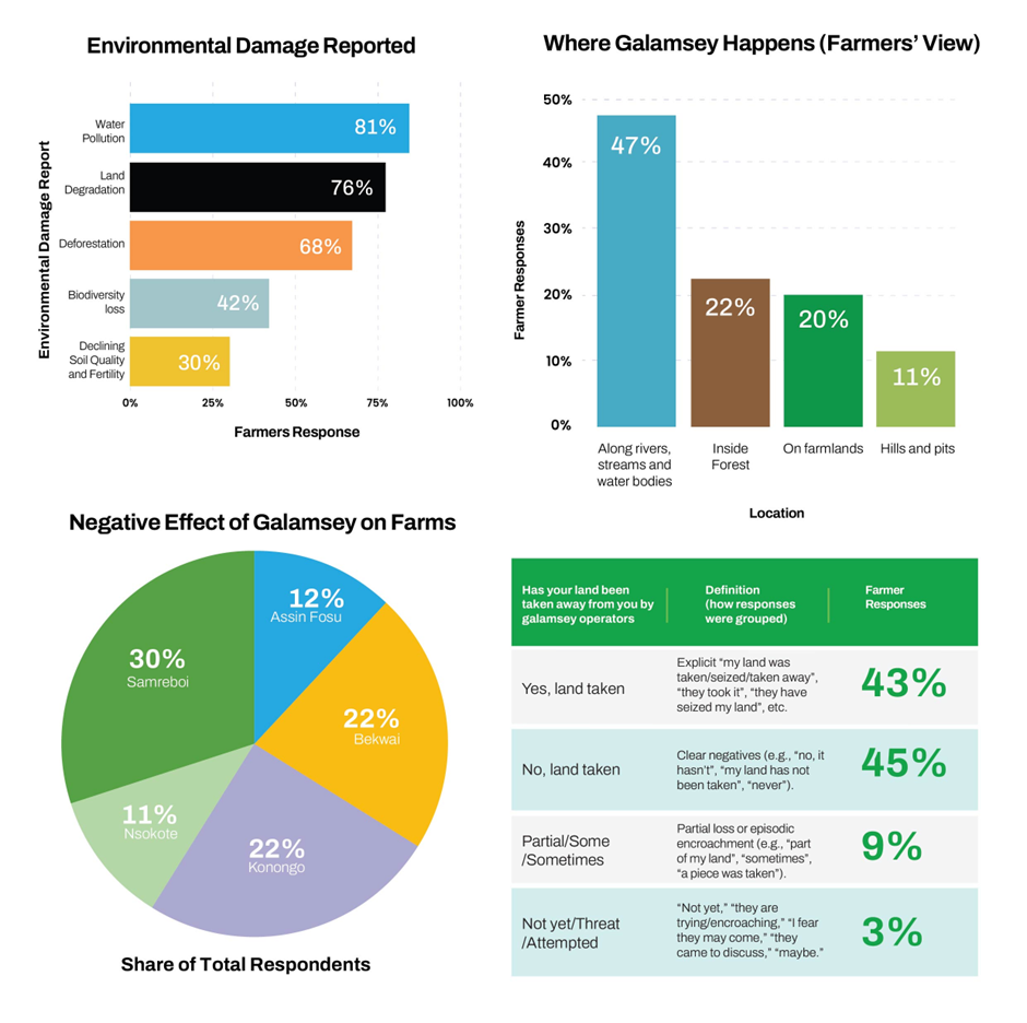
Based on the survey findings, ETG, and its partner foundation Beyond Beans, have tailored local awareness campaigns and farmer training programs to support community-led reforestation projects in ETG’s Ghanaian sourcing landscapes. As part of this effort, ETG is in the process of establishing a consortium to restore abandoned gold mines through reforestation and welcomes partners to support and scale this initiative.

